Sunday, 14 November 2010

The East Coast and Blue Penguins...

After a great Saturday evening on the TSS Earnslaw with dinner at the Colonel’s Homestead, followed by a sheep rounding and shearing demonstration, Sunday saw us heading back to the east coast in our quest to see the little blue penguins come ashore. We headed out of Queenstown via Frankton, through the Kawarau Gorge with views of Roaring Meg at the hydro power station.


We then proceeded through Cromwell and Clyde then followed the road between the Dunstan Mountains and the Raggedy to Lauder, Idaburn and Ranfurly (where we will return on Monday to cycle on the Otago rail trail). We then dropped into Palmerston and picked up the coast road heading north to visit the Moeraki Boulders (below) and head to our campsite at the mouth of the Waitaki River.


This campsite was a stark contrast to the regimented (and crowded) one in Queenstown – lot of space, very relaxed, free laundry and cheap internet access!
We took a walk to the beach and to the mouth of the river – it was blowing a gale, but as a bonus reward we came across a seal on the beach who showed interest in us being there, so it was a quick photo and move along rather than disturb him!
In the evening we returned to Oamaru and could see (with binoculars) the penguins amassing off the shore. It was not long before they started coming in and as the light faded so they came ashor and made their way up the rocks where we were stood. An incredible experience to have these tiny penguins come so close.


Friday, 12 November 2010

Queenstown - New Zealand's playground!

Thursday 11th November. Today we revised our plans further and elected to head for Queenstown a day ahead of schedule as we had not really needed the extra time at Milford Sound and on the Milford road, so we elected for the easy drive to Queenstown which would enable us to use our extra day later in the week to get back to Oamaru for an evening visit to see the blue penguins emerging from the sea, as we had been unable to hang around late enough when last there (it had been lunchtime and the penguins emerge at about 8.30pm) – we’ll fit that in between Queenstown and Ranfurly as we travel quite a way east when we go o Ranfurly in any case..... and we do want to see those penguins!

So, a tour along the lake front at Te Anau and then out on Route 94 with a consistent view of mountains as we headed through Mossburn (coffee and carrot cake), on to Route 97 to Five Rivers to pick up Route 6 which lies between the Eyre and Hector mountains. We followed this to Fairlight where we saw the station for the Kingston Flyer which advertised vintage steam train journeys at 11.00 and 2.30pm.... it was about 11.45! The station did look a little derelict but we elected to continue to Kingston and explore things further there.

Kingston sits at the southernmost tip of Lake Wakatipu, the same lake that has Queenstown on it about 40km further north, so we had plenty of time for meandering. We turned off to explore the railway only to find it sadly neglected, though it has clearly been restored at some stage but has now fallen into some state of disrepair and needs a serious amount of TLC. There were signs of recent life but the cafe was closed and the ticket office had a notice stating ‘closed until further notice’.


We meandered further north, the road following the edge of the lake with numerous pull off points. We stopped at one of these for our lunch and sat on the shore of the lake soaking up the view of the crystal clear water and the backdrop of the Eyre Mountains and then continued towards Queenstown with the Hector Mountains being replaced by The Remarkables. As we got to Franklin we diverted via the old gold prospecting town of Arrowtown and spent a few hours wandering around the town, visiting the old Chinese prospectors settlement and finishing up by eating ice cream.... cake and ice cream in one day; I must schedule some exercise!


We then dropped into the back of Queenstown and soon found our campsite before having a wander down to the quay and having a brief walk round to get our bearings, checking out where the TSS Earnslaw departs from (Saturday evening’s plan!) and checking out the range of activity shops, eateries and bars. Queens town is the busiest place we have been to since Christchurch, though there is no ‘bustle’ as such.

Friday: A bright and breezy morning saw us wandering down (via the 76 steps down to the town centre) to the shoreline of Lake Wakatipu and ambling along the promenade heading out of town admiring the rock formations, the Remarkables and the activity on the lake (jet boats, fishing boats, bird life). Our return journey was timed to include coffee on the wharf coupled with a bit of people watching before we wondered to the gondola where we had lunch booked. The upper gondola station gave fantastic views of Queenstown and Lake Wakatipu so we spent some time enjoying those and watching people on the Luge before we went to lunch. This was a rather magnificent buffet which extended to five courses if you include coffee; complete with soup, seafood, salads, a range of hot dishes and a wide selection of desserts.

After lunch we completed the Skyline circular walk which helped compensate for some of the calories consumed, and then headed for a ride on the luge, a twisting downhill run on a toboggan type sled on wheels, with a return trip by ski lift for any subsequent runs. Heather braved a single run down but did not overly enjoy it while the guy who only climbs hills on his bike for the descents went round again!


By now it was heading towards 4pm and we had an appointment with Kiwi feeding time at the nearby Kiwi Birdlife Park (which was right next door to the gondola base station) so we headed down and had an enjoyable couple of hours wandering around the rescued wildlife and watching the Kiwis (which are kept in a ‘natural’ environment as possible). The Kiwis are clearly quite happy as they are now breeding successfully.

Saturday started sunny and breezy with acres of blue sky and promises of temperatures in the mid to high twenties. We took a drive out along towards Glenorchy, the “Gateway to Paradise”. The road follows the shore of the lake and is incredibly hilly as the shoreline goes from beaches to cliff face. On the way we had incredible views of the Humboldt Mountains, Pigeon Island and Pig Island. We had coffee in Glenorchy itself before walking the circular walk out to Glenorchy Lagoon via raised walkways across the marshes, and back via the Glenorchy golf course. A good section of this was across marsh land, along streams and by the lagoon itself, this yielding a variety of wildlife including black swans, teal, ducks, mayflies, dragonflies, yellow hammers and a range of other birds.

After the walk we headed back towards Queenstown stopping for lunch at Wilson Bay. Unusually we had to share this bay with other people as there were a range of mountain bike tracks which were popular with cyclists (it was Saturday!) and there were also some families and a group of youngsters sunbathing.

After lunch we headed back to Queenstown and out to the famous Kawaru Bridge bungy jumping site where we enjoyed watching a few jumpers getting wet. Neither of us felt inclined to participate though we were tempted by the “too chicken” T-shirts!

It was then time to head back as this evening sees us on the TSS Earnslaw for dinner at Walter Peak at the Colonel’s Homestead – should be good...

Tuesday, 9 November 2010

Manapouri and Fiordland

Sunday 7th November: A damp start to the day as we headed north out of Invercargill before turning north-west at Winton proceeding through Nightcaps where we got glimpses of blue sky and on to Ohai where we had sightings of snow peaked mountains breaking through the cloud base. We then cut through some minor lanes (unsealed – lots of loose gravel!) to join the ‘scenic route’ to Manapouri which gave us full views of the mountains forming the Fiordland National Park. We headed north and were in Manapouri for lunchtime so we checked in to the campsite before taking a walk along the beach and through coastal woodland to Pearl Harbour (!) where we called in to the Real Journeys office. The lady at the campsite had suggested changing our pick-up point for our Doubtful Sound cruise to the campsite rather than Te Anau and reflecting on this we spoke to the very helpful girl in the Real Journeys office who changed the pick-up point, refunded the difference in price (in cash!), and moved our cruise forward 24 hours as this fitted better with our plans giving us two clear days post the Doubtful Sound trip to explore the Milford Sound Road.

The second half of our walk included a stop for cooling drinks (one of us sampling another NZ beer!) and a meander along the upper coastal path back to the campsite.
After dinner we took the short walk to the beach to watch the sun disappear behind the mountains in a sea of crimson as a few small birds fed off the sand flies and the gulls soared overhead across the lake. Perfect.


A leisurely start the next day as we had a pick-up at 11.55 for our overnight cruise on Doubtful Sound, so before that we took a walk away from Manapouri (ie in the opposite direction to yesterday’s walk) , dropped down to the beach and just sat watching the water and admiring the scenery. It was then back for our pick up by bus which took us back to Pearl Harbour where we boarded Realjourneys’ catamaran to cross the island studded Lake Manapouri. This was a 50 minute journey to the (hydro) power station visitor centre where we switched to a coach to complete the 30 minute crossing over Wilmot Pass to Deep Cove. As we descended Wilmot Pass we got our first glimpses of the stunning Doubtful Sound and very soon we were at Deep Cove Wharf and boarding the Navigator, a vessel which accommodates 70 passengers but on this occasion would have just under 50.

The scenery around the fiords is absolutely stunning, and while we were pleased to be blessed with another sunny day, the waterfalls were (we were assured) not at their best as there had been no rain for a few days. We cruised into a couple of the arms before finding a quiet area in Crooked Arm for some ‘activities’. Mark went kayaking with about 20 others while Heather joined a group in one of the small tender craft. This moves you much closer to the surface of the water and enables you to get really close to the sheer rock faces when the great height and detail of the rock formation can be really appreciated. We both managed to stay dry and elected not to join the small group who went swimming; 430 metres gives a new meaning to ‘the deep end’!

After this and some delicious soup we cruised on to the end of the Sound and out into the Tasman Sea where we got pretty close to a colony of Fur Seals, followed by the sighting of a small number of Fiordland Crested Penguins on the rocks. We also saw a number of Shags, but they are no longer a novelty!

It was then time to head back up the Sound and it was soon dinner time (and an excellent dinner it was too). At dessert time, Heather and another lady were each presented with a slice of chocolate mud pie with two candles on it and we all sang ‘Happy Birthday’, even though Heather’s was a little early. After dinner there was a short and informative presentation on the history of the Fiords and the local wildlife.


Next morning (Happy Birthday Heather!) we were half dressed when the PA announced that there were Bottlenose Dolphins at the bow, so it was a quick pulling on of the rest of our clothes and out to the bow to watch three of these chaps playing in the bow wave – what an experience! It was then breakfast time before heading into Hall Arm where we sighted a couple of blue penguins swimming and jumping alongside us for about 10 minutes. At the end of the arm the boat was silenced – everything turned off – and we all remained silent for five minutes and just listened to nature, something we rarely get chance to do at home without hearing traffic, an aircraft, or somebody on a mobile phone!

It was then time to cruise back to Deep Cove, retrace our steps over Wilmot Pass and the boat trip across Lake Manapouri to end what really was an awesome experience; and I think that word has been used absolutely correctly in this case, unlike we hear so often.

So, Tuesday afternoon and a quick replenishment of supplies in Te Anau before heading along the Milford Sound road. There are many walks along this road but we decided to do most on the way back, just stopping off three times en route for Milford. At one of these stops we were harassed by a Kea, a type of mountain parrot which are adept at stealing anything they can and then wrecking it! We admired it and escaped mostly unscathed.....


We had originally planned to stop part way along for our overnight based on dire warnings of how tricky this road is; however there was little traffic and conditions were good, though the descent after the Homer Tunnel is rather twisty and steep.

We arrived at the campsite in Milford to find just two spaces left, the alternative being a 40km trip back to the next nearest campsite. So, we booked in and then drove to the Wharf at Milford Sound and were somewhat taken aback to find that is all there is! One wharf, four or five cruise companies, a few walking tracks.... We looked at the available cruises though most offices were not staffed – prices were not too ridiculous (we had not planned to cruise on Milford Sound) but we had noted a special offer at the campsite so returned there. The saving has about paid for the campsite fees and we’re now booked on the 0850 ‘small boat’ cruise for tomorrow morning!

Wednesday 10th November. A reasonably early start as we needed an 0815 departure to ensure we were at Milford Sound Wharf at the appropriate time. We had heard overnight rain but by the time we were up it was more showery, and there was not much wind. We were soon at the wharf and aboard the Mitre Peak II with a few other people (24 of us in total). Milford Sound is much more compact (and smaller!) than Doubtful Sound, with higher mountains, less depth and, especially following the rain, more waterfalls, several of which the boat put its bow under, giving people the option of a shower if they chose to do so. We cruised under the renowned Mitre Peak (1683m), passed Copper Point where a couple of seals were spotted swimming and headed towards the Tasman Sea. On the way we also sighted a couple of Fiordland Crested Penguins on the rocks who were soon joined by another four. We then circled out at sea, which was a bit bouncy in a small boat, to return into the Fiord passing Dale Point and Stirling Falls (four times the height of Niagara, but not as much water). We then came across a colony of young male fur seals who were frolicking in the water. We returned after just over two hours having circumnavigated the whole fiord, which gives some sort of comparison to Doubtful Sound which we had journeyed around for about 8 hours travel time without covering all of it.


As it was now just turned 11.00 we headed a short way back towards Te Anau and found a pull in for coffee and then on to try out a few of the shorter walks. The first of these was the Chasm where water runs in torrents in a deep trench in the rocks; then we took the Lower Hollyford Road, an unsealed road, to Gunns Camp and on to Moraine Creek which was crossed by an amazingly narrow and wobbly suspension bridge! Heather wasn’t too keen on this but I did complete the crossing (and the return one) managing to get it oscillating nicely!


We then went on a bit further walking for about 15 minutes up a reasonable gradient to the Humboldt Falls. These receive few visitors as they are 17km away from the main road and the road ends at the start of the Hollyford Track which gives options of 3hr and 6hr walks (one of which is “suitable only for experienced trampers”) and not much else!

It was then time to return to the proper road, afternoon tea (in the campervan!) at Knobs Flat and so back to Te Anau where we booked in to the campsite. We decided on a walk before dinner and wandered in to town. While there we met up with some people from Michigan who we had become friendly with on the Doubtful Sound cruise, not least because one of them was the lady who also had a birthday while on that trip. We got chatting and ended up having dinner together, so tonight the Jones chef got a night off!

Friday, 5 November 2010

As far South as we can go... Stewart Island

Friday 5th November: An early start this morning as we had a ferry to catch! It had been raining since the early hours and was still raining when we left the campsite heading for Bluff, the ‘Lands End’ of New Zealand. By the time we got to the Ferry it was more showery but was blowing somewhat and the swell was at about 1.5m. The catamaran to Stewart Island (population about 400) took about 100 but there were only half that on board; the ride across was about an hour long at about 25 knots through choppy seas.... exhilarating if your breakfast behaved!


It was dry on arrival but with grey skies though we only had a few showers during the day. We opted for coffee at the ‘Just Cafe’ before deciding on the plan of action, it was then on to the Ruggedy Range Wilderness Experience booking office where we opted for the island tour with the two Dutch people who were already there. After a quick conversation all four agreed that a tour modified to allow us a walk back round one of the many headlands would be ideal, with an opt out option if the weather deteriorated drastically!

There are only 26km of roads on the island (most of it is a conservation area, the Rakiura National Park) so we had a tour of the only township (Oban) before heading to all the extremities possible including Leask Bay, Deep Bay, round Back Road and across to Lee Bay. The sky was looking rather grey when our driver stated that it was decision time regarding the walk, but with nobody being brave enough to wimp out the walk was on!

The Horseshoe Point Track keeps (very!) close to the edge of the headland which sits between Horseshoe Bay and Halfmoon Bay, which through a quirk of history have had their names transposed and hence each one’s name best describes the other. The path climbed high and then plunged to sea level repeatedly through the 1.5hr walk, sections of path were quite vertigo inducing dirt tracks close to the cliff tops, other parts crossed golden sandy beaches. At the end of the track we joined the road and wandered onto a few beaches (devoid of people) until at Butterfield Beach we came across a large male Fur Seal. On our approach he raised his head and promptly put it back down, clearly seeing us as no threat; we did report it to the Department of Conservation office in case he was in trouble but apparently it is quite normal for them to just sleep on the beach for hours before returning to the sea; clearly they have few enemies in the locality....


We finished our visit with a walk over the headland closest to the ferry terminal which gave us superb views of the harbour from one side and led us down to more golden beaches on the other. We explored a few rock pools before passing back over the headland to catch the return ferry; the trip back was quite a bit calmer and included sighting a leaping dolphin which was a great bonus.
Before heading back to the campsite we headed to the end of the Bluff Peninsula which is apparently 18,958km from London!


Saturday we had no plans other than the need to stock up on provisions so we wandered in to Invercargill, shopped, and then spent some time in Queens Park which included a ‘winter garden’ (hot house), an aviary with a wide range of rescued native birds, animal areas, ponds, and gardens. We then headed off on a circular tour along the coast to Riverton where we had lunch at The Rocks overlooking the Bluff Peninsula. We then continued through Orepoki heading inland through Te Tua, Pikopiko and returning via Otautau and Isla Bank.

Tomorrow we plan to head off to Manapouri on the edge of the Fiordland National Park where we expect to have views of Mount Titiroa, the Flat Mountain and Cathedral Peaks.

Thursday, 4 November 2010

Heading South....

Tuesday 2nd November: We headed west out of Fairlie over Burkes Pass to Lake Tekapo. Traffic was again close to non-existent and what there was comprised mainly coaches full of Japanese tourists and a good number of campervans. We admired the beautiful Lake Tekapo and headed on to the shores of Lake Pukaki which is absolutely stunning, and turned north to head towards Mount Cook. The road follows the shore of the lake and after a few kilometres we came across Peter’s Lookout where we parked up for coffee and to enjoy the incredible views across the lake which included Mount Cook. We met a couple of Australian girls here who recommended the walk down to the lake which they had just arrived back from huffing and puffing, and with a healthy glow! After chatting to them for a while we felt compelled to visit the shoreline and duly scrambled down; the perspective from the shoreline was certainly worth the climb we faced to get back to the van.... While on the shore we met a couple from Guildford (!) who had left the UK in June and were not sure when they would be returning – so, all those who thought our holiday was long.....


After returning back to the lookout we stayed for lunch and experienced a number of tour buses which came, let the passengers off, got them back on and wended their way onwards in very short time. We timed one: six minutes!

Presently we made our way to Mount Cook. With views of the lake to our right and the mountains ahead it was an amazing drive, though it was a case of better to travel than to arrive as the end of the road at Mount Cook is a collection of facilities including restaurants, hostels and hotels but you are so close to the mountain itself that you fail to get its real impact which had been far better from a few kilometres away.

We had to return by the same route but by now the sun was high in the sky and the flat calm on the lake enabled clear reflections of the shoreline and the mountains – today was turning out to be another ‘wow!’ day.

We steadily wended our way south through Twizel to Omarama where we found the campsite and parked up by a stream where I think once again we will awake to birdsong.

The following day we were away by 0900 and headed south-east following the shores of Lake Waitaki (more stunning scenery). After a short while we had a brief delay while a flock of sheep blocked the road as they were transferred, but we were soon underway again and we were in no hurry in any case. Lake Waitaki then turned into the Waitaki River, passing through several dams on its way to the sea. We followed the river as far as Duntroon where we took the minor road via Ngapara to Oamaru on the coast. This road follows the ‘Vanished World Trail’ which gives the appearance of having been formed through a fault line opening and then refilling over many years. Along this road we stopped at the Anatini whale fossil site where a number of fossilised bones are on view where they were found, still embedded in the limestone. It was during this part of the journey that we crossed the 45th parallel, the point at which we were equal distance from the equator and the South Pole.

We had coffee at Oamaru where they have a ‘Steam Punk’ exhibition: steam artefacts ‘enhanced’ with additional objects such as steel coils and missiles.... we also visited the penguin colony but they usually return to shore late afternoon so we were a bit early and expected other opportunities later.


We then hugged the coast as closely as possible to Shag Point where we parked up in the hope of sighting shags, seals and perhaps yellow eyed penguins, though it was still only mid afternoon. The seals were active in the rocks with six sighted in total, there were plenty of Shags and then after a walk along the coast path we sighted three yellow eyed penguins, claimed to be ‘probably the rarest of penguins’. We were very grateful for binoculars as otherwise identification would have been challenging at best, assuming we had spotted them at all!

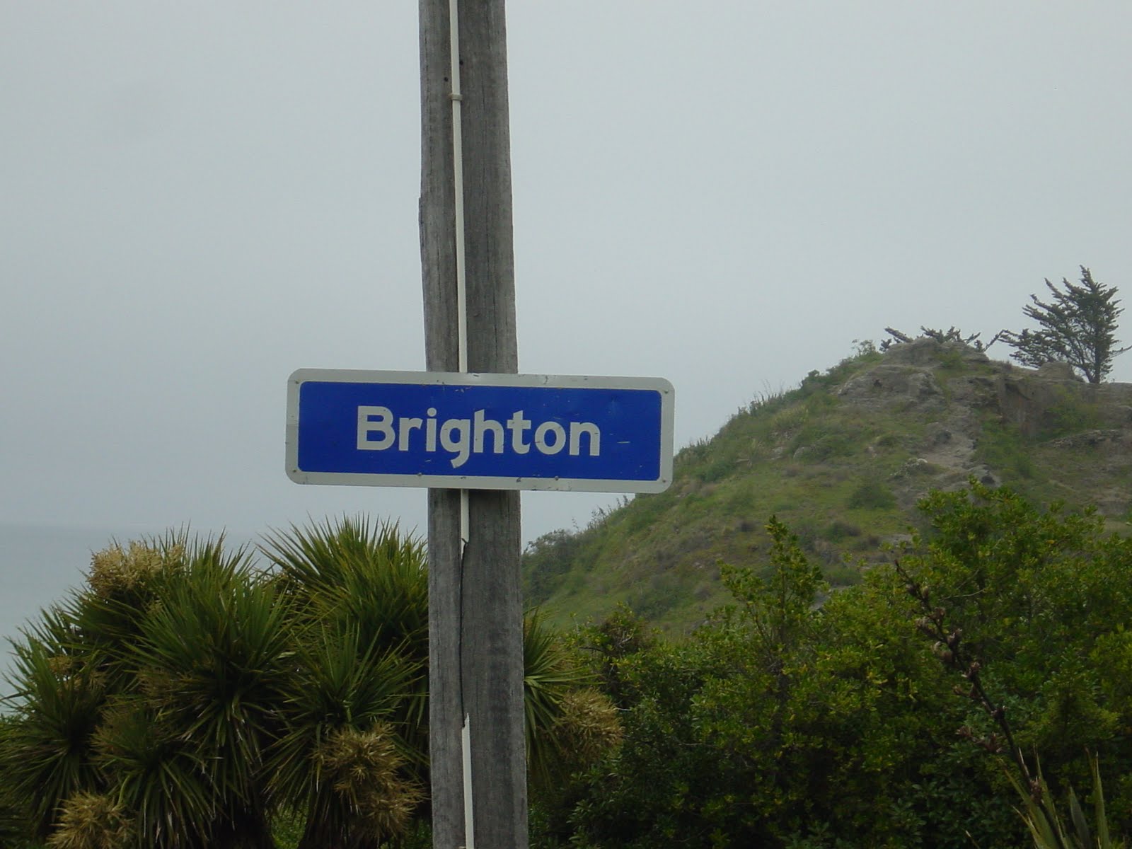
It was then time to wend our way to Dunedin and find (with a little difficulty) the coast road which took us to Brighton (!) where we camped for the night at a campsite mainly populated by 1950 style ‘static’ caravans.


Wednesday started dull and a bit misty as we headed along the coast heading south past the mouth of the Taieri river, coffee at Milton, through Clarkesville to pick up the scenic route through the Catlins at Balclutha. The Catlins are reminiscent of the South Downs only much bigger and with small windy roads with no traffic. We diverted off the main route to Nugget Point; this entailed an unsealed road which was mainly single track with passing places. At Nugget Point we saw a large number of seals playing in the water, basking in the sun and generally being seals! By now the sun was out though the wind was still keen, but our vantage point was fairly sheltered and we spent a couple of hours watching the seals and admiring the view before a picnic lunch and making our way back to the ‘scenic route’.


We meandered on now heading west as we reached the southern-most coast of South Island, stopping off at Matai Falls and Horseshoe Falls (which entailed an energetic walk with some serious climbing!) before stopping for ‘afternoon tea’ at Niagara Falls which are little more than a burbling stream – somebody had a sense of humour!


It was then time to press on to Invercargill where we were booked into the Amble inn campsite as tomorrow we’re off to Stewart Island to make sure we go as far south as we can!

Monday, 1 November 2010

Campervan Day 1

It's November 1st and we are now 'campers'! We picked the campervan up this morning, stocked up with provisions and then were about to head off but instead did a quick return trip to the Charlotte Jane to take their key back.... oops!

We then headed out to Darfield to pick up the inland scenic route through Windwhistle, Mayfield and Arundel to Geraldine. Although we had mountains in our sights for most of the time, the 20km stretch from Mayfield to Arundel is almost dead straight and although it was good for geting some distance travelled it was a little lacking in variety! After Geraldine things changed as we headed through Gapes Valley, Beautiful Valley and Cattle Valley to Fairlie. We had not made any arrangements for tonight so rang ahead to Fairlie campsite when we stopped for a cuppa and that's where we are right now - complete with free internet access which is considerably faster than that which was available in Christchurch!

We talk a walk into town after dinner - 10 minutes about covered it and at 8.30pm the only place open was a restaurant, all other bars and cafes being closed; the only disturbance overnight is likely to be the birdsong as the sun comes up, which is a great way to be woken.

Tomorrow we plan to head for Lake Pukaki and Mount Cook, not a lot of miles but plenty of sight seeing and options for a range of activities.

Sunday, 31 October 2010

Two Days in Christchurch

Saturday 30th October: We met with my Auntie Anne’s sister, Irene today for coffee. We had not met Irene before but had heard much about her from my Dad. We got on fine and time went too quickly as always; we had a firm deadline as we were booked to go to Lyttelton (on the Banks Peninsula) for a harbour cruise followed by a Gondola ride. After a walk, much chatting and a coffee we went for our shuttle bus from Cathedral Square. By this time the sun had come out and it looked like our decision to delay this trip from the previous day (cloudy and damp) had been the right one.


It was a 15 minute bus ride to the harbour where we boarded a small catamaran for our harbour tour. The main objective was to spot some of the very rare Hector dolphins and we were blessed with our first sighting as we emerged from the inner harbour; we then had regular sightings throughout the trip, as well as spotting other wildlife and learning something of the geography and history of the area. Lyttelton is where the first settlers arrived, with the first ship in being the Charlotte Jane (cross reference to earlier post re where we are staying!). We stayed on the upper deck throughout the tour, though this was rather bracing at times and one of us was showing signs of having caught some sun by the time we returned two hours later!

On from here we had a short ride to the Gondola which takes you high above the town and gives spectacular panoramic views. Visibility was good, though the brisk breeze was not conducive to staying outside for too long. We returned from the Gondola on the local bus which gave us sights of a few more of the suburbs of Christchurch.


Sunday again dawned clear and showed promise of a good day. We were already booked on the Transalpine Railway journey; 4.5hrs through the Southern Alps from Christchurch to Greymouth. This journey is really quite something, climbing to Arthurs Pass at 737m above sea level (where it was really quite chilly!) and then dropping down through the 8km Otira tunnel and back to (almost) sea level at Greymouth. We had an hour for lunch before reversing the trip and seeing the views from the other direction. With snow still on some of the mountain tops and ice fed rivers the scenery really was quite something.


A shuttle bus home from the station saw us back in time to do most of the packing before dinner as tomorrow we pick up the campervan which will be our home for the next six weeks as we tour the two islands. It may be a while before the next posting as we will be reliant on getting an internet connection somewhere convenient!